
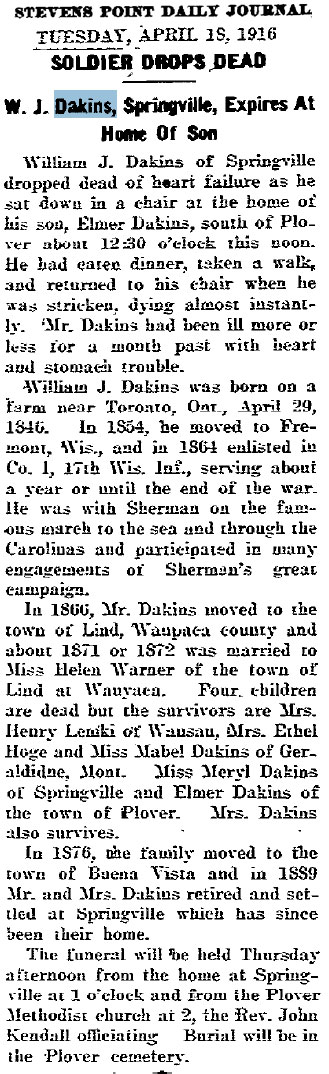
I started using the Google Maps system to plot some of my family’s locations awhile back, but I never got around to finishing it. Recently, I plotted most of the major Milwaukee locations for my family and it’s interesting to see how it looks once you know where things are. I’ve always had an idea, but it’s better to see it in it’s final state.
An interesting thing about Milwaukee is that it went through a massive addressing overhaul in 1931, so a lot of the address information from census records is different today. Fortunately, I found a website that has some basic conversion tools and was able to (hopefully) pinpoint these addresses. Give it a try sometime. It’s neat to see how your family moved around.
View Milwaukee Locations in a larger map and access to the legend.


Thanks for the tool! I was down around the that area tonight. I was at Wolski’s for an hour or so. The area on your map is still a Polish neighborhood, kind of cool!
Al
Yeah, I drove around a bit down there a little while ago. It’s amazing how many houses they can fit in one lot. :)