1892 Grafton Plat Map
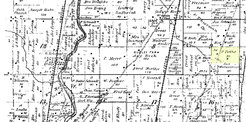
According to the 1892 Grafton Plat Map, Johann’s father, (Henry) Peter Thielke, owned land in the northeast section of Grafton in Ozaukee County.
John probably did not live on this land in 1892, but may have lived there when he was living with his parents. According to a listing from the 1900 Ozaukee County Directory, it lists John Thielke living in section 9 of Grafton, which is where this land is located. So, John probably farmed on this land after his parents passed away.
It is located on land currently intersected by County Highway C. I actually drive through the land pretty often when I visit my brother in Port Washington. It is a main road from Grafton to Port Washington along Lake Michigan. It looks like his land bumps up against what is now Lions Den Gorge Nature Preserve. There was actually a little writeup about this location in an article in the Ozaukee News Graphic Pilot from July 1986 titled, “Some Settlements Faded With the Passage of Time”:
Then, there was something called Lion’s Den. The den has been described as a secret ravine along the bluffs of Lake Michigan, about three miles north of Grafton. Two stone-carved lions greeted visitors at the entrance to the site. Prohibiition bootleggers reportedly hid their booze in a cavern at the ravine.